
Editor’s Note: The Astana Times continues its Forgotten Cities of the Silk Road series, exploring Kazakhstan’s tentative UNESCO World Heritage sites. This edition highlights three major archaeological sites in the Kyzylorda Region, including the ancient settlements of Zhankala, Zhankent, and the fortified complexes of the Zhetyasar oasis.
ASTANA — Scattered across the southern steppes of Kazakhstan, the ancient cities of Zhankala, Zhankent, and the Zhetyasar oasis reveal deep layers of urban life, regional power and transcontinental exchange. Spanning more than two millennia, these archaeological sites trace the rise of fortified settlements, trade networks, and spiritual centers in the Kyzylorda Region.
The ancient settlement of Zhankala. Photo credit: wildticketasia.com Click to see the map in full size. The map is designed by The Astana Times.
Zhankala: a citadel by the river
Located 115 kilometers west of Kyzylorda city, the ancient settlement of Zhankala is situated near the former flow of the Zhanadarya river. According to archaeologists, it is linked to the historic town of Zhent, a once-thriving center along medieval trade routes connecting Central Asia and the Middle East.
The site features a classic tripartite layout common in medieval Central Asian cities, comprising a citadel, shakhristan (residential inner town), and rabad (outer commercial district).
The citadel, a square structure approximately 75 meters on each side, contains remnants of a palace and a corner tower, all of which are surrounded by fortification walls and a moat.
The shakhristan, covering 23 hectares and enclosed by five-meter-thick walls, contains several major structures, including two caravanserais (roadside inns for travelers). Beyond it lies the rabad, a large outer district measuring about 1.8 kilometers by 1.5 kilometers. Archaeologists have found evidence of residential estates, public buildings, irrigation systems and religious structures, identified through low mounds and dense concentrations of ceramic fragments.
Excavations conducted in the 1960s and 1970s by Soviet archaeologist Sergey Tolstov revealed numismatic evidence of wide-ranging cultural and commercial links, with coins and goods tracing ties to China, India, Central Asia, the Middle East and Europe.
Zhankent: from Oguz capital to Kazakh stronghold
Roughly 20 kilometers southwest of the Kazaly district in the Kyzylorda Region, the ancient settlement of Zhankent spans a long history from the first century B.C.E. to the 18th century C.E. Also known as Urkendeu or Yangikent, the site served as the capital of the Oguz State from the 10th to the 12th centuries and was home to the governor, known as the Yabgu.
Zhankent’s 375-by-225-meter layout features a central citadel that rises approximately eight meters high. Archaeological remains include a main street connecting the city’s eastern and western gates, as well as evidence of residential zones. The Myntobe burial ground, situated at the northern end of the site, comprises hundreds of graves spanning nearly two millennia.
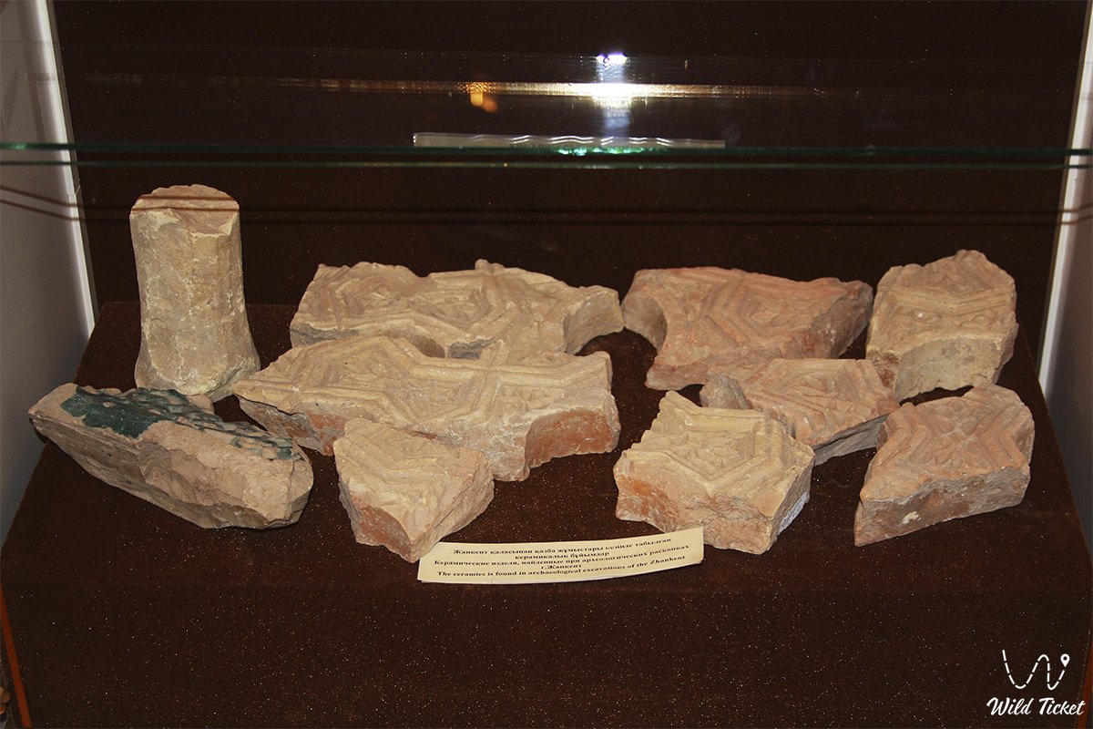
The ceramics found in archaeological excavation of Zhankent. Photo credit: wildticketasia.com
The excavations that started in 2006 uncovered 12th-13th century residential structures and a unique Oguz altar decorated with ram-head motifs. Written references to Zhankent first appear in Arabic and Persian sources of the 10th and 11th centuries, with continuous mentions over six centuries.
The city’s strategic position along the Syrdarya river enabled it to act as a cultural and commercial link between the steppe, Khorezm, the Aral Sea basin, Central Asia, and the Mediterranean. In later centuries, it served as a residence of Kazakh khans, reinforcing its status as a regional power center.
Zhetyasar oasis: fortified legacy of the Kangju state
The Zhetyasar Oasis, located in the East Aral Sea area and along the middle Syrdarya River in the Kyzylorda Region, contains a dense cluster of fortified settlements, burial grounds, and archaeological layers. These sites are linked to the Kangju state and date from the first millennium B.C.E. to the early ninth century C.E.
Initial studies by Tolstov in 1948, followed by decades of excavation by the Khorezm archaeological expedition, divided the region’s history into three cultural phases. The earliest settlements had oval and rounded forms, rising up to 25 meters high. Later phases introduced additional rings of fortifications, oval towers, and multi-story residential complexes, which were repeatedly rebuilt over centuries.
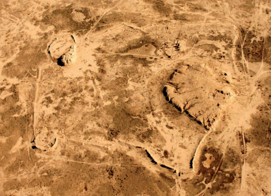
Zhetyasar oasis: fortified legacy of the Kangju state. Photo credit: old.archaeology.kz
Each Zhetyasar site was strategically placed near water sources and surrounded by necropolises containing thousands of burials, grouped into four types and three construction forms. Archaeologists discovered goods such as amber from the Baltic, cornelian from India, glass from Syria and Egypt, silk from China, and ornaments from Europe and Iran.
The distinctive urban planning, defensive architecture, and conservative building practices set Zhetyasar culture apart from its Central Asian neighbors. Unlike other regional settlements, none of the Zhetyasar towns were unfortified.
Protection and preservation
All three sites – Zhankala, Zhankent, and the Zhetyasar Oasis – are under the jurisdiction of the state public institution responsible for protecting historical and cultural sites in the Kyzylorda Region, which is part of the regional department of culture, archives and documentation.
Other sites on Kazakhstan’s UNESCO World Heritage Tentative List within the Fergana-Syrdarya Corridor include Otyrar, Sauran, Kyshkala, Asanas, Syganak, and Yassy-Turkistan.
Kazakhstan also contributes to other Silk Road nominations, including the Volga-Caspian Corridor, which features Kyzylkala, Saraychik, and Zhayik, and the Silk Roads: Early Period (Prehistory) route, highlighting burial complexes such as Besshatyr, Boralday, and Esik.