
Editor’s Note: The Astana Times continues its Forgotten Cities of the Silk Road series, exploring Kazakhstan’s tentative UNESCO World Heritage sites. These ancient settlements, now in ruins, once thrived as trade, culture, and innovation centers. In this edition, we turn to Sauran as one of the most prominent medieval cities in the Syrdarya region. With its well-preserved fortress walls, advanced water system and rich archaeological legacy, Sauran stands as a testament to the ingenuity and endurance of Silk Road civilizations.
Other nominated sites within the Fergana-Syrdarya Corridor include Asanas, Kyshkala, Otyrar, Yassy-Turkistan, Zhankala, Zhankent, Syganak, and the Zhetyasar oasis settlements.
ASTANA — Once a thriving hub of commerce, learning, and military strategy along the Silk Road, the ancient city of Sauran stands today as one of Kazakhstan’s most remarkable remnants of medieval urban culture. Its ruins, long admired by explorers and history enthusiasts, reveal the grandeur of a fortified settlement that played a central role in regional politics, trade, and religious life from the 10th to the 18th centuries.
Sauran, one of the most prominent medieval cities in the Syrdarya region. Photo credit: premiera.travel. Click to see the map in full size. The map is designed by The Astana Times.
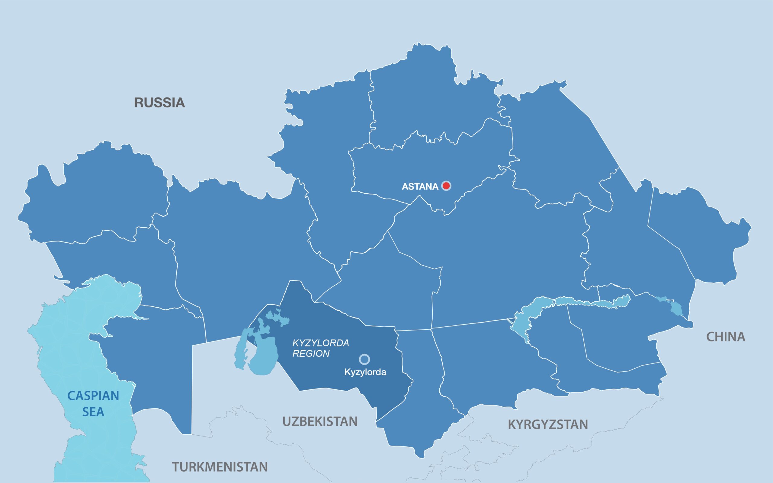
The site is approximately 15 kilometers west of the modern village of Sauran and near the administrative border of the Turkistan and Kyzylorda regions. It is part of the Azret-Sultan State Historical and Cultural Museum-Reserve, listed as a monument of national significance.
Fortress of ingenuity
The archaeological complex of Sauran spans approximately 50 hectares and features an oval-shaped settlement surrounded by walls standing up to six meters high. Stretching 800 meters from northeast to southwest and 500 meters from northwest to southeast, the city’s original layout reflects careful urban planning and strong fortifications.
The northeastern gate served as the main entrance. It was guarded by two two-story towers and a 20-meter-long defensive corridor. Seven additional towers lined the 2,360-meter-long outer wall. A deep moat, measuring three meters deep and up to 20 meters wide, encircled the city.
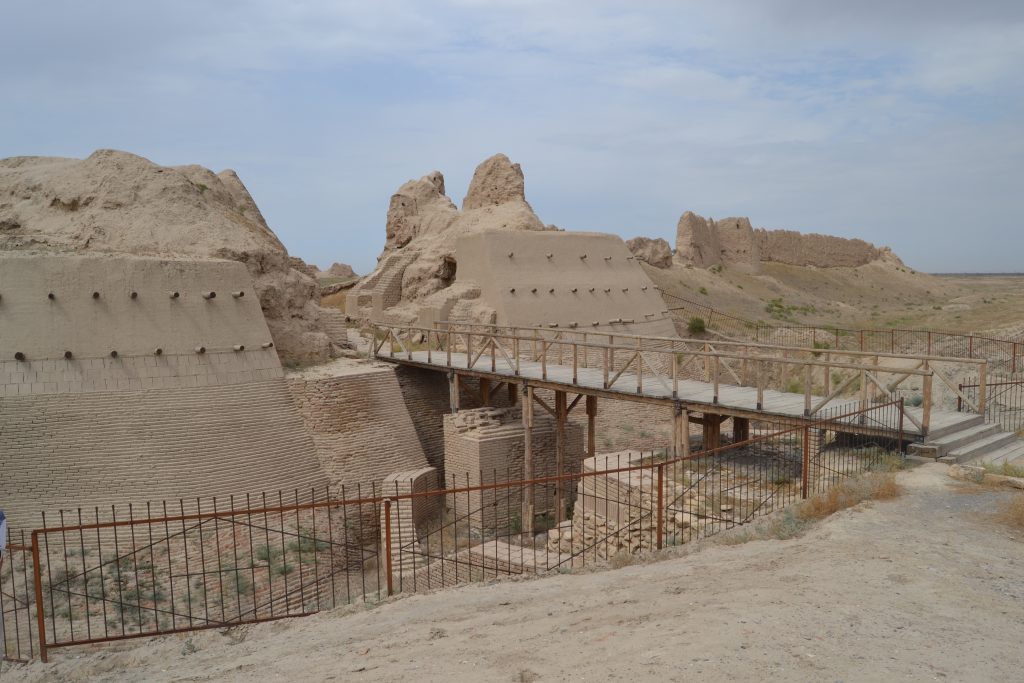
Sauran as a testament to the ingenuity and endurance of Silk Road civilizations. Photo credit: azretsultan.kz
Inside, a primary avenue led from the gate to a central square approximately 120 by 40 meters in size, dividing the city into two nearly symmetrical halves. A network of alleyways connected residential and civic spaces.
Archaeologists consider that the central ruins include remains of a mosque and a madrassa, the region’s earliest formal educational institution. Artifacts such as ceramics and gypsum fragments point to a highly literate and advanced society. Sauran’s residents are also credited with developing a pioneering water management system.
Ingenious water supply
Among Sauran’s most impressive features is its underground water supply system. The network of subterranean pipes, stretching over 110 kilometers, showcases the city’s ingenuity in adapting to the dry climate of the Syrdarya region.
The city’s sustainable approach to agriculture and urban planning allowed it to flourish for centuries, surrounded by productive farmland and supported by a strategic location along trade routes.
Sauran and Karatobe
Historical sources trace the roots of Sauran to an earlier settlement known as Karatobe, located approximately three kilometers southeast of the current ruins. By the late 13th or early 14th century, people began leaving Karatobe, and its residents are believed to have established a new town, the present-day Sauran.

Sauran as a testament to the ingenuity and endurance of Silk Road civilizations. Photo credit: azretsultan.kz
Medieval geographers and chroniclers, including al-Istakhri in his “Book of Routes and Realms” and Ibn Hawqal in 976, mentioned Sauran in their works, testifying to the city’s value in the medieval Muslim world. The town was also documented in accounts of Armenian King Hetum’s diplomatic travels, further attesting to its reputation on the Silk Road.
Preserving a legacy
Sauran’s significance extends beyond its silent walls. It is part of the tentative UNESCO World Heritage site, Silk Roads: Fergana-Syrdarya Corridor.
Other nominated sites within the Fergana-Syrdarya Corridor include Asanas, Kyshkala, Otyrar, Yassy-Turkistan, Zhankala, Zhankent, Syganak, and the Zhetyasar oasis settlements. Each illustrates the region’s vibrant Silk Road heritage.
Kazakhstan is also home to components of the Volga-Caspian Corridor of the Silk Roads, which followed historical routes from the Aral Sea region to the Volga River valley, passing through the Ustyurt plateau, Mangyshlak peninsula and Ural River valley. This corridor includes the ancient settlements of Kyzylkala, Saraychik and Zhayik.
These sites reflect the diversity of civilizations that once flourished across Central Asia.
Additionally, the Silk Roads: Early Period (Prehistory) nomination includes the necropolises of Besshatyr, Boralday and Esik, which showcase Kazakhstan’s ancient roots well before the Silk Road era.