
Editor’s Note: The Astana Times continues its Forgotten Cities of the Silk Road series, exploring Kazakhstan’s tentative UNESCO World Heritage sites. This edition features the Volga-Caspian Corridor and its three key archaeological sites, including Kyzylkala, Saraishyk, and Zhayik, spanning the Atyrau, Mangystau, and West Kazakhstan regions.
ASTANA – Once a vital artery of Eurasian trade and diplomacy, Kazakhstan’s Volga-Caspian Corridor connected Central Asia with the Volga River basin and the Caspian Sea. Cities such as Kyzylkala, Saraishyk, and Zhayik flourished as hubs of commerce, culture, and religion, bridging the gap between the nomadic and urban worlds between the 10th and 16th centuries.
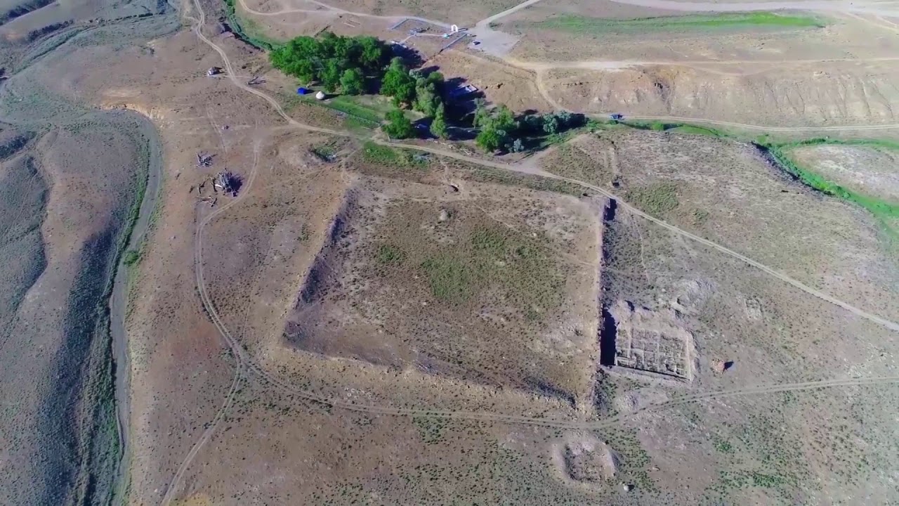
Kyzylkala birdview. Photo credit: mangystau.inmap.kz
Archaeologists and heritage experts are working to preserve this historically rich frontier and advance its bid for United Nations Educational, Scientific and Cultural Organization (UNESCO) World Heritage status.
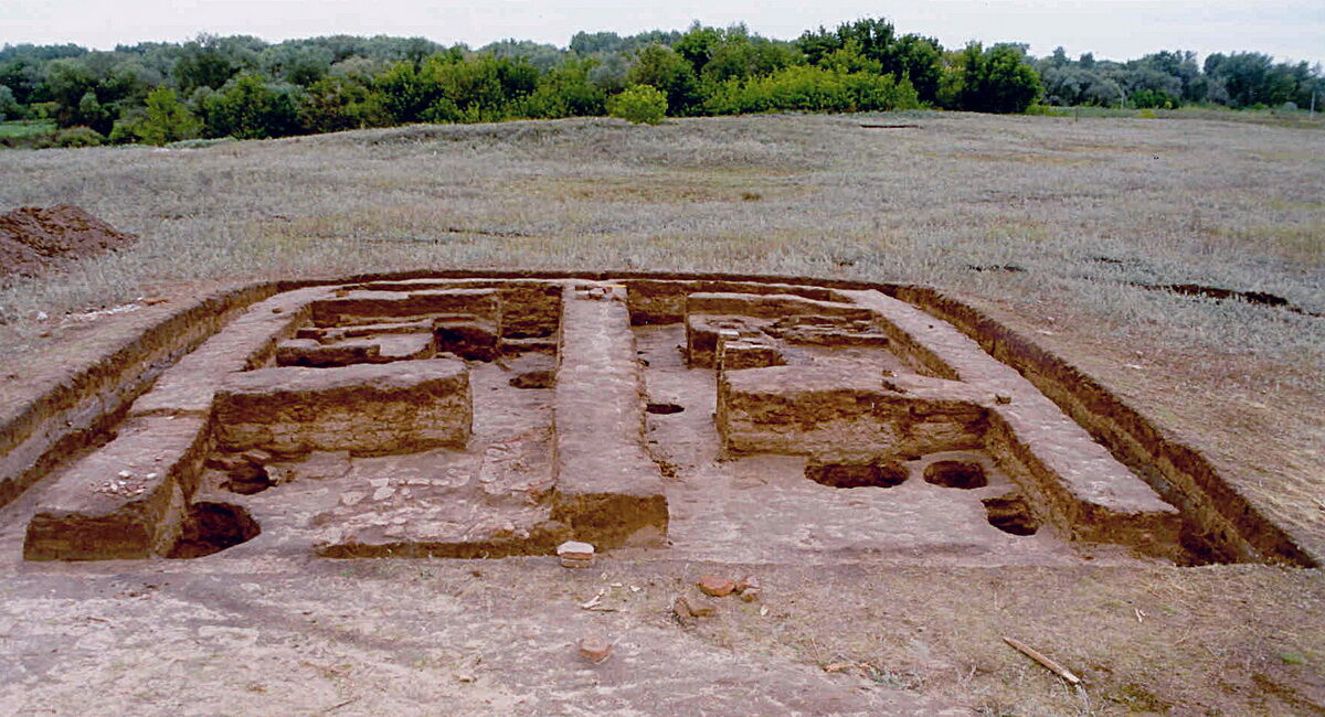
Kyzylkala: trade outpost of the steppe
The medieval settlement of Kyzylkala, a fortified outpost that thrived between the 10th and 13th centuries, was located near the Shetpe village in the Mangystau Region and encompassed approximately 50 hectares. It featured a central fortress with 13 towers, a rabat (residential district), and a necropolis.
Initiated in 1978 and revived in the 2000s, excavations uncovered no evidence of the Golden Horde-era layers, suggesting Kyzylkala’s decline predated the Mongol invasion.

Kyzylkala. Photo credit: mangystau.inmap.kz
However, archaeologists believe it may be the “impregnable fortress of Mangyshlak” described in medieval texts. Constructed with massive stone blocks, the fortress, measuring approximately 110 meters by 115 meters, was surrounded by four-meter-high walls and angular towers. It likely served as a Khorezmshakh outpost safeguarding regional trade.
The city supported glass and ceramic production, as well as metalwork and jewelry-making. Finds include glazed pottery, carved bricks, bronze and silver artifacts, and ceramic vessels used for gold-plating amalgams. Excavations also unearthed a grain hook, millstones, and agricultural remains, suggesting that residents cultivated grains and melons, supported by groundwater from the Akmysh River and Karatau springs.
According to Arabic historian Al-Istakhri, Kyzylkala may be the fortress Mangyshlak mentioned in 10th-century sources. Despite fading by the late 13th century due to shifting trade routes and environmental change, the site remains a key testament to frontier commerce and settlement.
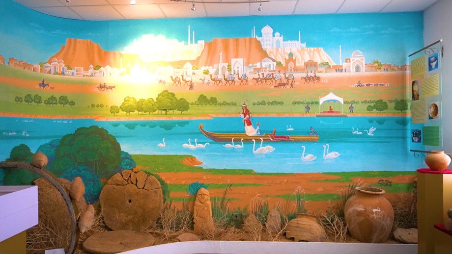
Saraishyk: the spiritual capital of the steppe
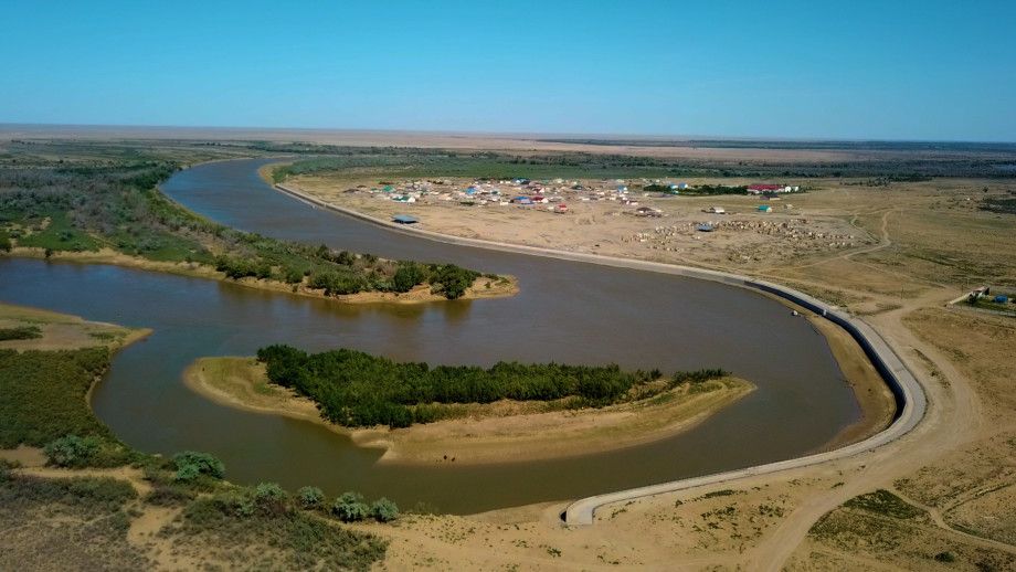
Situated along the Ural River near present-day Atyrau, Saraishyk was founded by Batu Khan of the Jochi dynasty in the 13th century. It later became an important center as the capital of the Golden Horde and then the Nogai Horde, helping to spread Islam in the region.
Legends speak of a sugar lake created for a khan’s daughter, symbolizing the wealth and imaginative culture of Saraishyk. Photo credit: Maksim Maslov / mir24.tv
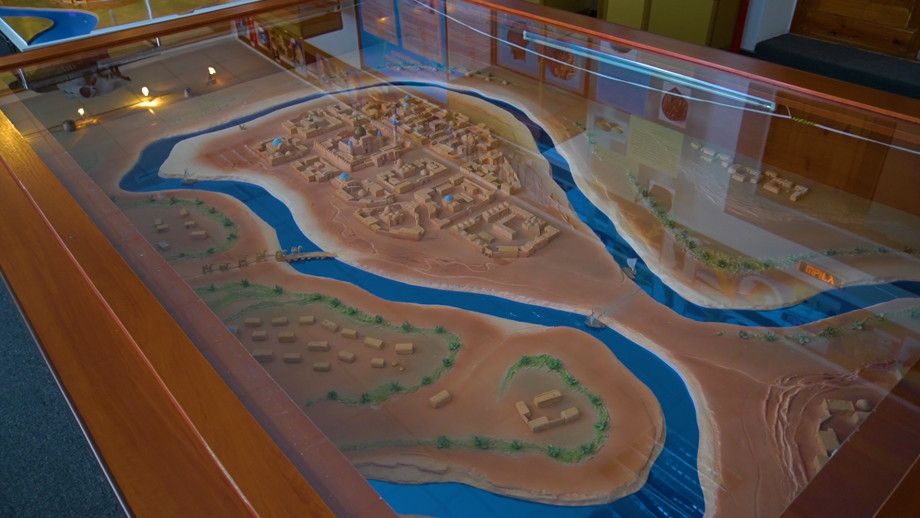
Saraishyk hosted the courts and mausoleums of key rulers, including Mengu-Timur, Toktay, Zhanibek, Berdibek, and Kasym Khan of the Kazakh Khanate. A central node on the Silk Road linking Urgench and the Volga, the city featured elite crafts and international trade, with excavated items including Syrian glass, Chinese porcelain, Iranian bronze, and Khorezm ceramics.
Ruins of Saraishyk show advanced infrastructure before its 1580s destruction by Cossack troops. Photo credit: Maksim Maslov / mir24.tv
Destroyed by Cossack troops in the 1580s, Saraishyk’s ruins reveal advanced infrastructure: pressurized water supply systems, sewage networks, and two-story mud-brick homes with three to four rooms.
“I have traveled all over the world. It turns out that Saraishyk is the largest city after Baghdad. It houses the khan’s headquarters, four mosques shine with their beauty, and there are numerous inns. But what astonished me was not that; it was the water supply system. In Saraishyk, water comes into every house on its own. When I saw this, I was beyond amazed,” wrote famous Arab traveler Ibn Battuta in 1334 in his “Journey through the Desht-i-Kipchak” book.
Situated along the Ural River near present-day Atyrau, Saraishyk was founded by Batu Khan of the Jochi dynasty in the 13th century. Photo credit: Maksim Maslov / mir24.tv
Russian archival documents from 1861 describe a citadel at the site, which archaeologists now aim to locate. Other legends speak of a sugar lake created for a khan’s daughter, symbolizing the wealth and imaginative culture of Saraishyk. Although ruined, the site still preserves the remains of up to nine khans and represents a pivotal political and spiritual cornerstone in the history of the Eurasian steppe.
Zhayik: urban culture on the edge of nomadic frontiers
Located 12 kilometers south of Uralsk, near Mount Svistun, the Zhayik settlement reflects the urban development of the Golden Horde during the 14th century, particularly under the rule of Uzbek Khan and Zhanibek Khan.
Though medieval Arab geographer Al-Idrisi mentioned a trading town in this area as early as the 10th century, the site itself was only rediscovered by chance in 2001 during a pipeline survey. Formal excavations began in 2005, led by the History and Archaeology Center and the Margulan Institute of Archaeology.
Zhayik: urban culture on the edge of nomadic frontiers. Photo credit: zhaikpress.kz
Archaeologists uncovered a complex settlement featuring residential estates, craft workshops, brick kilns, and a hammam. Built of sun-dried brick, the hammam occupied approximately 120 square meters and included an octagonal hall, side washing rooms, and an advanced underfloor heating system. Ceramic water pipes supplied the washrooms, and stone basins collected the flow. These features made hammams among the most important public buildings in Islamic cities, second only to mosques.
Two kilometers west of the main site, a necropolis was revealed to contain richly decorated domed mausoleums with polychrome glazed tiles. Among them was a rare conical-shaped structure topped with a rounded vault, enclosed by a mudbrick wall.
Challenges of preservation and future potential
Despite their significance, the corridor’s heritage faces threats. Erosion from nearby rivers endangers the sites, and the village built over parts of Saraishyk complicates excavation. The considerable distances between the three sites raise concerns about the cohesion of a single UNESCO nomination.
Experts recommend including nearby caravanserais (roadside inns for travelers and traders) and oasis settlements to reinforce the historical integrity of the corridor and better reflect its function as a Silk Road frontier zone.
Unlike more homogenous corridors, the Volga-Caspian route bridged nomadic and sedentary cultures, facilitating rich and layered exchanges across economic and cultural divides. Its strategic location at the crossroads of Europe and Asia shaped centuries of movement, belief, and innovation.
Other sites on Kazakhstan’s UNESCO Tentative List include Fergana-Syrdarya Corridor, which features Otyrar, Sauran, Kyshkala, Asanas, Syganak, Yassy-Turkistan, Zhankala, Zhankent and Zhetyasar oasis, and burial complexes such as Besshatyr, Boralday, and Esik in the Silk Roads: Early Period nomination.