
ASTANA – The Kazakhstan Garysh Sapary national space agency revealed satellite images that show the Caspian Sea drying up, as the seabed in the northern part denuded, the organization reported on July 11.
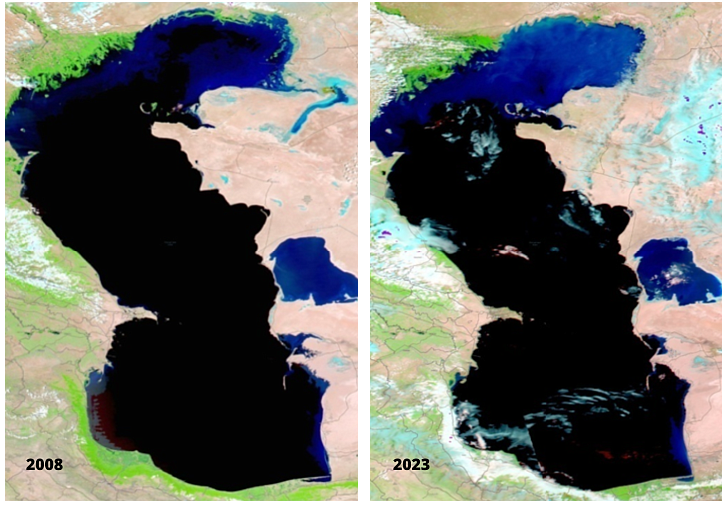
Images of the Caspian Sea drying up. Photo credit: Kazakhstan Garysh Sapary’s press service.
The agency has been monitoring the sea’s conditions for 15 years, collecting archival data of satellite images. They show that the water area of Kazakhstan’s part of the Caspian Sea has decreased by 7.1%.
The change in dynamics in the water surface for the period from 2008 to 2023 shows extensive areas of shallow zones near the city of Atyrau at the delta of the Zhaiyk River, which is the most vulnerable part.
Over 15 years, the water surface area of the Caspian Sea has decreased from 113,866 square kilometers to 105,745 square kilometers.
The agency emphasized the need to study this issue in detail, as the drop in the water level of the Caspian Sea could lead to negative consequences for the ecosystems and the marine sector.