
ASTANA – Sayram-Ugam national park is a hidden gem in southern Kazakhstan, located in the midst of the rugged Western Tian Shan Mountains, close to the border with Uzbekistan. Breathtaking landscapes, diverse flora and fauna, and rich cultural history add to the uniqueness of Sayram-Ugam.

Lake Makpal. Photo credit:qazaqgeography.kz. Click to see the map in full size. The map in designed by The Astana Times.
Location of the Sayram-Ugam National Park
Spanning 149,000 hectares, the national park is located in the Kazygurt, Tolebi and Tulkubas districts of the Turkistan Region, 280 kilometers from the city of Turkistan. It includes the spurs of the Talas Alatau, and also the Ugam, Karzhantau and Boraldaytau massifs.
It was established in 2006 to conserve the region’s unique flora and fauna. Mountains, rivers, waterfalls, and mountain lakes with icy crystal water make up the unique landscape of this region.
Lake Susyngen. Photo credit: qazaqgeography.kz
Main features
The park is home to snow leopards, lynx, brown bears, wolves, many rare birds, and more than 1,600 species of plants, including 62 from the Red Book of Endangered Species.
The park also encompasses several important cultural and historical sites, including ancient petroglyphs and stone monuments. The Great Silk Road passed through the park’s territory, leaving a trail of historical monuments along the entire route of the caravans.
Sayram-Ugam national park is a must-see destination for nature lovers, fans of hiking, and wildlife enthusiasts seeking to explore natural beauty and cultural heritage.
Hiking and equestrian trails
There are ten equestrian and hiking routes 604 kilometers long, 187 kilometers of hiking trails, 231 kilometers of horseback, and 186 kilometers of car routes.
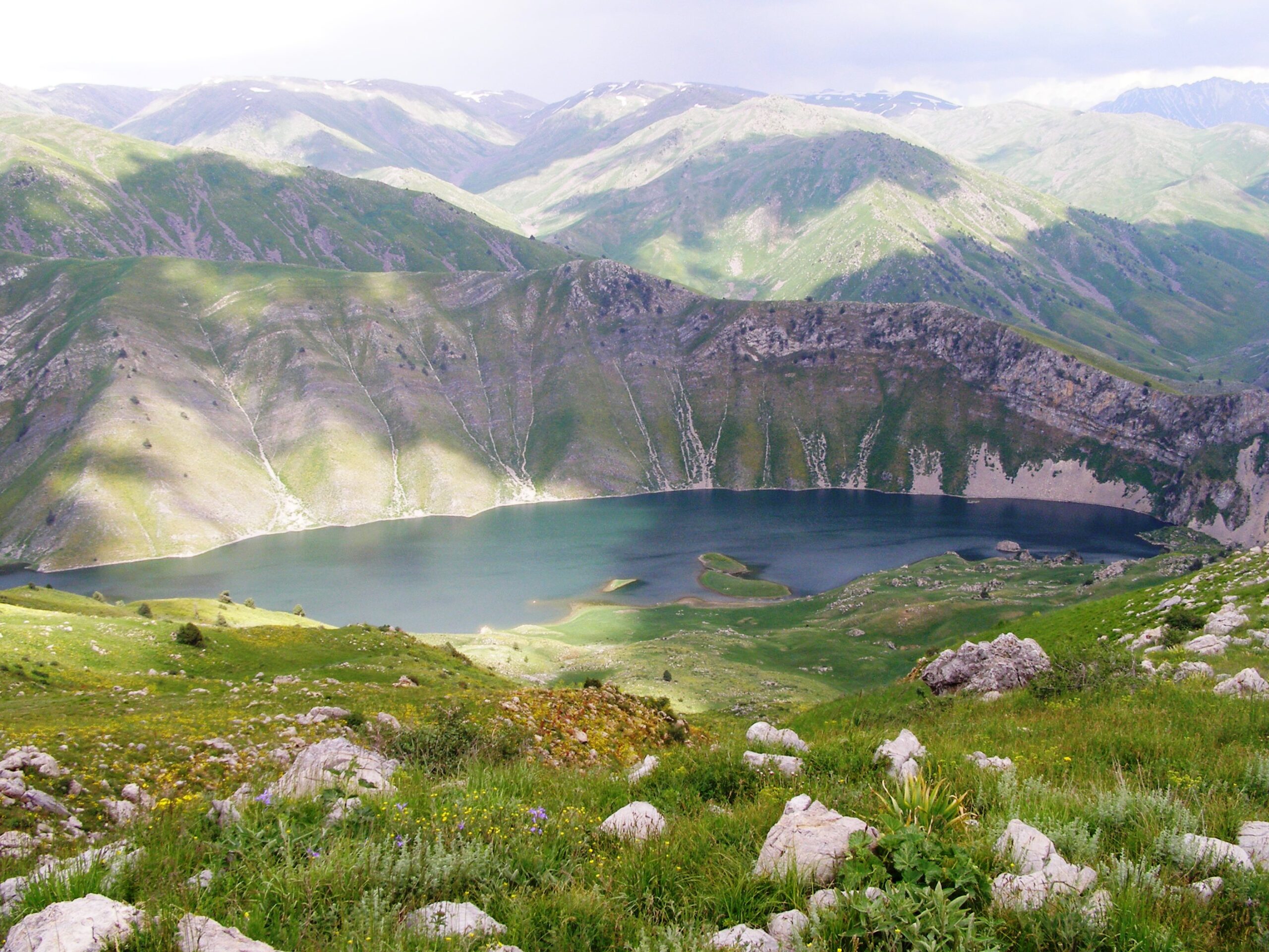
No. 1 Route – Lake Makpal
Lake Makpal is located at an altitude of 2,100 meters above sea level. With a golden eagle soaring in the air, snowcocks screaming on the gentle southern slopes, and graceful mountain goats grazing on high grassy areas under the rocks, it represents nature’s ideal harmony.
The main points in the route are the Ugamsky cordon ridge and Ugam – Diermenbastau gorge passing. The trail is 45 kilometers long.
No. 2 Route – Lake Susyngen
The second route is Lake Susyngen, located at an altitude of 1,700 meters above the sea. From time to time, it inexplicably becomes shallow. Hence the name “susyngen,” which roughly translates as the water has gone into the ground.
The 31-kilometer route’s main attractions include the Ugam River, the Aigyrzhykkan River, the Zhauzhurek mountain area, the Akkoylek Mountain, and the Togutba mountain pass.
No. 3 Route – Petroglyphs of the Sazan Ata River
One can get there by hiking and horse riding. This 12-kilometer route on a picturesque river gorge impresses with its magnificent juniper forests and dense birch. At the end of the route is a plateau or the Valley of the Ancestors, where animal drawings are printed on the flat side of the black stones.
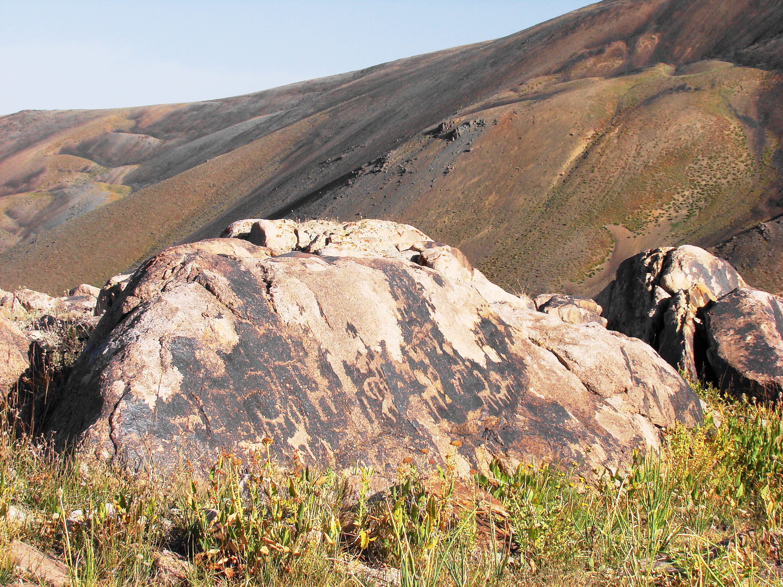
Petroglyphs on the stone, near the Sazan Ata river. Photo credit: qazaqgeography.kz.
Another route begins from the Saryaygyr River and ends at the South campsite. An old orchard garden, a favorite feeding place for bears in autumn, is located on the right bank of the Saryaygyr River. Menzbier’s marmots and mountain goats also inhabit these places. If you are lucky, you can meet them on the journey.
No. 4 Route – the Saryaygyr river – Susingen lake – South camp site
The route’s must-visit attractions include the Mynzhylky mountain area, the Tikenek mountain pass, the Akburkhan River, the Ulyzhurt mountain pass, the Kishzhurt mountain pass, Kyrykkyz mountain area, and the Badam River.
The Kyrykkyz mountain area, translated from Kazakh as 40 girls, is a unique natural phenomenon known for its ancient legend about these 40 girls.
According to the legend, a violent khan invaded one small village and captured 40 girls. When he and his army were going through the pass, an old man from the village chased them. The warriors wanted to seize him, but the old man began to turn to stone in front of the frightened and astonished enemies. Like the old man, the girls also turned to stone and escaped from slavery. The sandy rocks resemble tall figures crowned with “saukele,” the national headdress. Only 20 rocks maintained their form till today.
No. 5 Route – Vladislav Peak
Another breathtaking route is a 30-kilometer Vladislav Peak, located 3,632 meters above sea level. It can be reached by hiking and climbing. The highlight of this route is the Kopzhailau River, also called the Gorge of Wild Climbers, and Snezhny (snowy) mountain pass, located at an altitude of 3,350 meters above sea level.
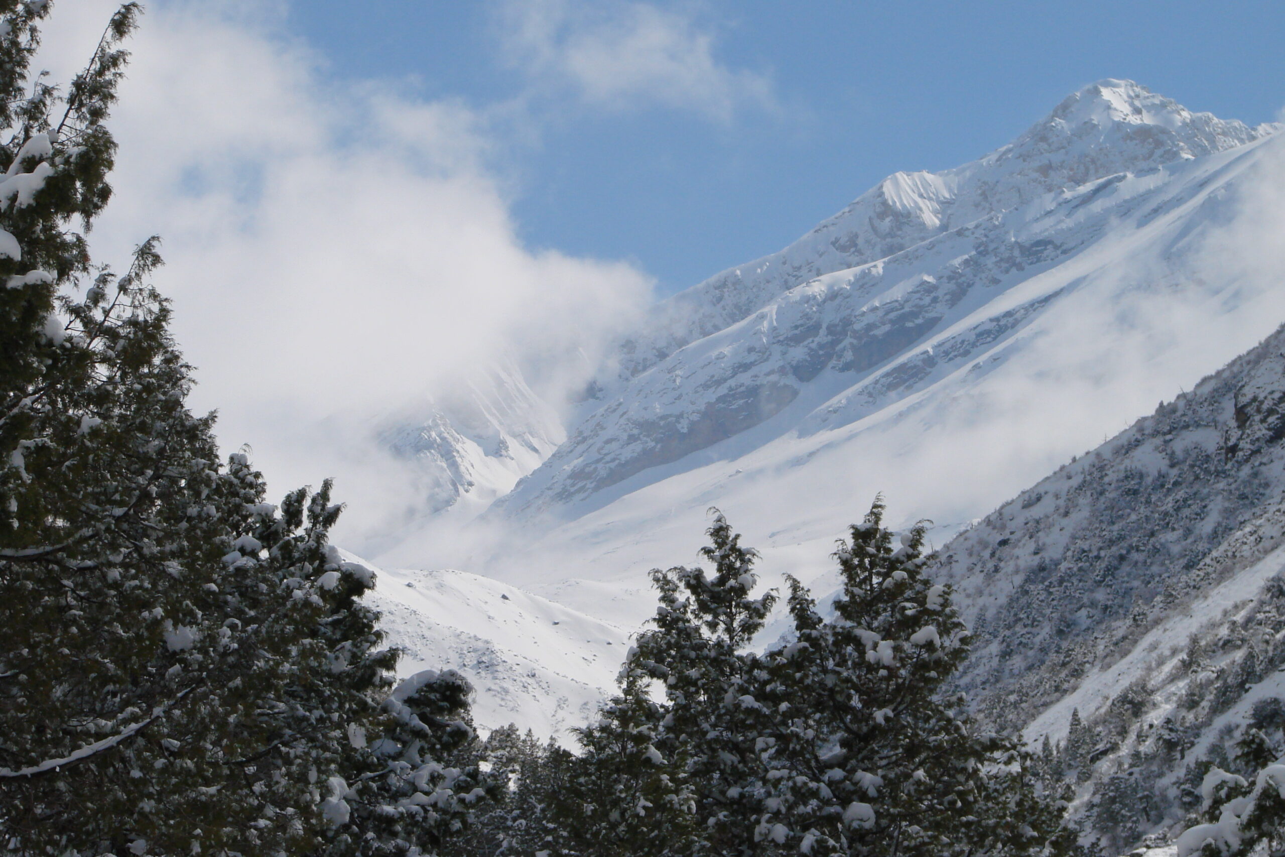
Vladislav Peak. Photo credit: qazaqgeography.kz.
Vladislav Peak’s northeastern side is steep, while the southwestern side is a smooth slope covered with small screens with stone slabs. From its top, you can enjoy a majestic panorama of the southwestern Tien Shan mountains, the Chatkal range, the Chimgan Mount, and the Pskem and Ugam ranges.
Best time to visit
The best time to visit the Sayram-Ugam national park is from May to October when the cool mountain temperature is approximately 20 degrees Celcius.
How to get to Sayram-Ugam National Park
The most convenient way to get to the Sayram-Ugam national park is by car, taxi, or on an organized tour from the city of Shymkent, which is 70 km away.
The entrance fee to the park is approximately 500 tenge ($1) per person.