
ASTANA – The Atyrau Region is where Kazakhstan began to develop the first oil deposits. Yet the region offers much more than just oil. The hidden gems include breathtaking natural sculptures, mountains, lakes, and an old city with a centuries-long history.

Akkegershin Plateau. Photo credit: Kazakhstan Travel. Click to see the map in full size. The map is designed by The Astana Times.
These places of attraction are becoming increasingly popular. Last year, almost 110,000 tourists visited the Atyrau Region, according to the regional department of entrepreneurship and tourism.
Akkegershin Plateau
Have you ever dreamt of walking on the surface of the Moon? Unless you get the unlikely opportunity to travel to the Moon, the experience can only be felt by visiting the Akkegershin Plateau, a 245 km drive from the city of Atyrau.
Akkegershin Plateau. Photo credit: kz24.news.
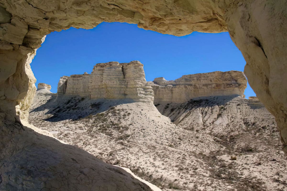
Located at the bottom of the former Sarmatian Sea, the plateau is 11 kilometers long and 7 kilometers wide.
The plateau landscape reminds of movies about the Moon or Mars. It is possible to find among the chalk deposits the remains of ancient animals that lived in the shallow Sarmatian Sea, such as ammonite shells and shark teeth. This makes this place a paradise for researchers.
Due to strong winds and rains, the forms of natural sculptures are constantly changing, creating multi-layered pyramids, palaces, and outlines of animals. The most popular rock for tourists is called “Three Brothers”.
The rock formations are around 60 meters high, enabling tourists to climb them.
According to scientists, the rocks of the Akkegershin Plateau started to form in the Jurassic Period. One of the rocks had a small hole, which was discovered when scientific expeditions began to be carried out in these places in the 1980s. Today, the hole has turned into a large opening called the “Gateway to the Cretaceous Kingdom”.
Inder Mountains
Back in the 18th century, famous German naturalist Peter Simon Pallas called the Inder Mountains a miracle of nature.
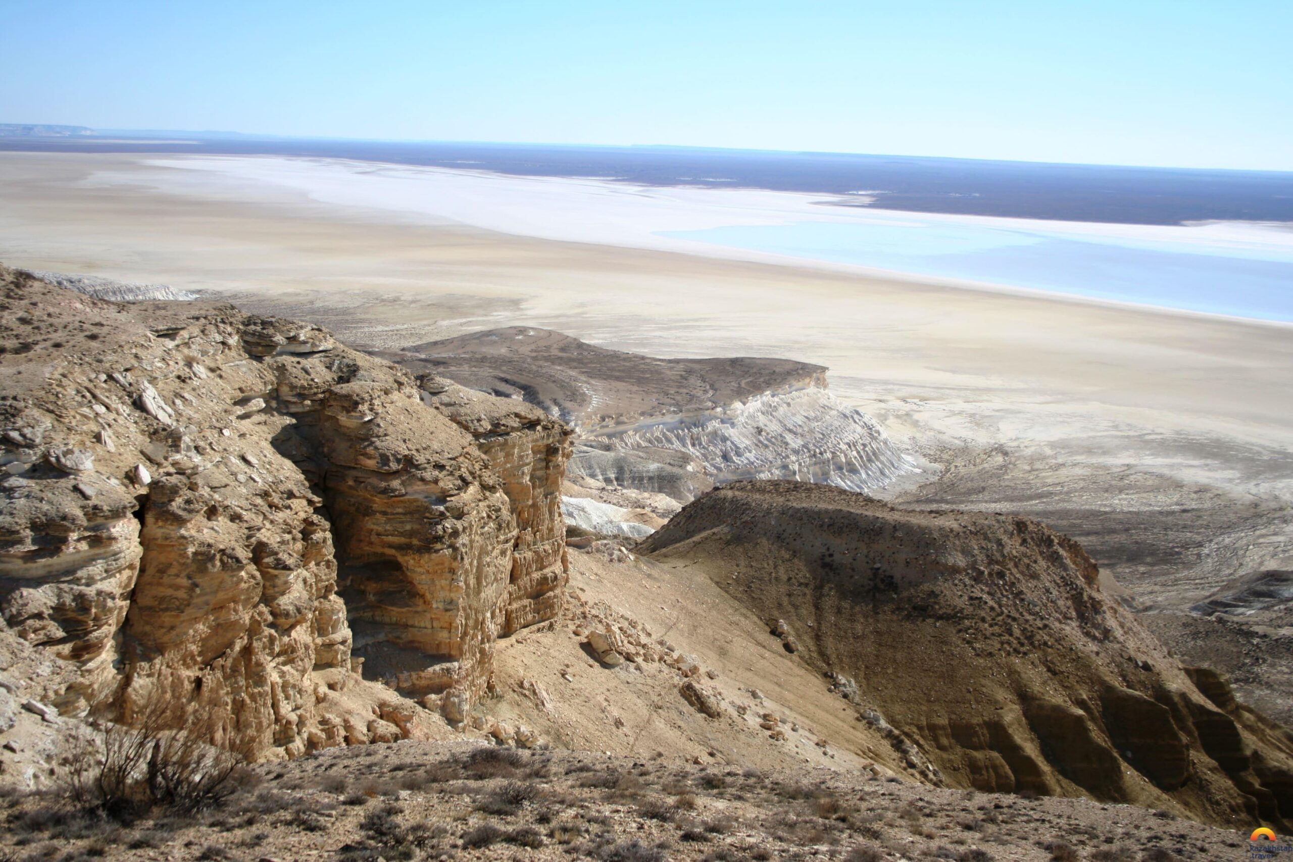
Inder Mountains. Photo credit: Kazakhstan Travel.
The mountains continue to attract tourists and scientists due to its unusual surface consisting of layers of multi-colored clay, gypsum, gravel, and shell.
The Inder Mountains are located in the Indersky district of the Atyrau region, 200 km from the city of Atyrau. The highest point is 54 meters above sea level. According to one of the versions, these mountains were once the islands of the Caspian Sea.
The terrain of the mountains and foothills is rich in flora and fauna, including black wormwood, blackberries, wild roses, feather grass, apple groves, tulips, as well as relic species, such as muzzle snakes.
Inder Lake
The north and northeast Inder Mountains are bordered by a salty Inder Lake.
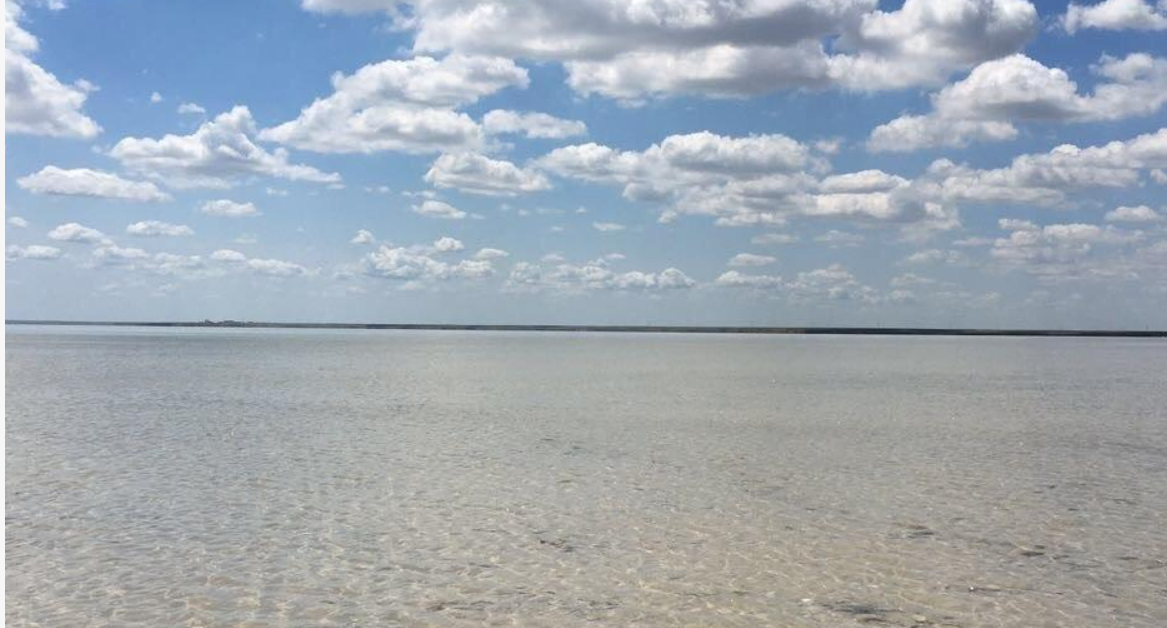
Inder Lake. Photo credit: Kazakhstan Travel.
It is the largest lake in the region 180 km away from Atyrau, named by locals “Tuzdykol” (salt lake). It’s 110 square meters in size and is fed by salt springs and rainwater. The lake not only attracts tourists because of its white glowing surface, but also due to its healing properties.
The ancient city of Saraishyk
Saraishyk was a medieval city established in the 10th-11th centuries at the border between Europe and Asia. It was the capital of the Golden Horde and a major trade center of the Great Silk Road. The caravan route from Europe and the capital of the Golden Horde to Iran, India and China passed through Saraishyk.
The settlement was located 50 kilometers north of the city of Atyrau next to the lower Ural River. It now sits near the contemporary Saraishyk village.
The ancient settlement is one of the oldest discoveries in Kazakhstan.